
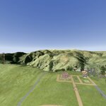
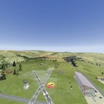
I made a couple of challenging race courses, the highlight being the one that begins at the large hangar on the west end of the runway. I tried to find a pilot spawn position with a good vantage point, but you will likely need nose, cockpit or trail cam to navigate the big obstacle ring course. The last thing I added was a scenario for those interested, which would require ordnance (preferably missiles or A10 30mm). The details for that are below. Or just cruise the Sierra Nevadas.
Scenario: Pre-DART (Downed Aircraft Recovery Team) Seek and Destroy
Situation. On 060730May2020, CPT David Orangeshirt made enemy contact while conducting aerial defensive patrols over the area southwest of FOB Californaracin’. After engaging and destroying one enemy victor, his AH-64 Apache Longbow was hit. While he was able to limp his bird from immediate danger, he could only manage approximately 2 clicks before having to make a rough landing into an adjacent draw. Prior attempts by blue ground forces to reach the crash site have been unsuccessful due to the remaining presence of enemy forces, as well as inclement weather. (See App A SALUTE report for details)
1. MISSION. Delta639 (that’s you) conducts immediate aerial sweep of southwest perimeter of FOB, close with and destroy enemy armor in the AO before they reach CPT David’s position. Then proceed to the crash site, identify both the pilot and bird, and give signal to him you have eyes on. Call it in to Ops, and RTB.
2. WHERE. The area SW of FOB Californaracin’ vicinity grid (see App. A)
3. Friendly Forces. NA
4. ENEMY. (See App. A)
5. Intel reports increasing activity in the area, mainly armor and/or light skinned recon. Weather is projected clear, 10 mile visibility; upon immediate takeoff and elevate to 1000 ft you should see the smoke from what remains of destroyed tank to your left front (WSW). At 1100-1200 ft, you should see the first of two signals of CPT David’s pos—violet smoke just west of destroyed tank. Once you have eliminated armor forces and approach the area marked by violet smoke, you should see his “red X” air panel just south. His position is in the draw between the two signals. He destroyed his bird and sensitive items yesterday and has taken up position within the burned cockpit. Best angle of approach would be from N-S.
D639
ATTACH
Appendix A
ACKNOWLEDGE THOMPSON
GEN
APPENDIX A SALUTE Report
S Approx. PLT size element (4-5 tanks).
A Enemy tank patrols.
L Vic. grid 218400 216540.
U Unknown.
T 060730May2020 (ongoing)
E Red forces in desert and woodland colored armor (similar to US M1A2)
