Creating photofield scenery

nono1928

New member
Hello,

I am new to Realflight and intend to create a photofield scenery of my local airfield. I have a few questions that I could'nt find answered in the forum, nor in the manual.

What kind of panorama projection is to be used (Cylindrical, Spherical, ...) to generate the panorama ?
Is there a limitation in terms of maximum resolution supported by RF ?

I understood that the center of the panorama should be aligned with the horizon. Are there any other points to be considered ?
I intend to use Hugin parnorama photo stitcher for that purpose.

Thanks for your advice
 
Well, in the meantime I did some tests and proceeded by trial and errors. I think I now understand how it works.
Here are my findings for anyone interested.

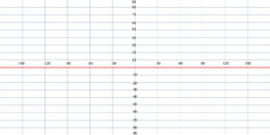
The panorama picture should be set according to this :

1667845296798.png

with height/width = 1/2 (180° / 360°)

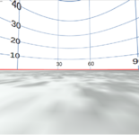
I loaded this panorama into the game and this seems to work perfectly :

1667845380513.png

I then tested the alignment in X & Y to understand how it works.

X is a tilt of the panorama along an axis defined at 45° heading
Y is a tilt along an axis defined at -45° heading

This is confirmed here :

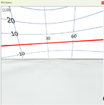
Test of -20° in X
1667845495647.png
1667845511851.png

Test of -20° in Y :
1667845612273.png
1667845535181.png


There is also an option to define the north

1667845565948.png
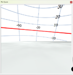
which results in -60° in heading as expected :
1667845585588.png

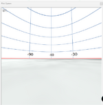
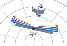
Finally I looked down at -90° :
1667845638501.png


We see that the tail of the plane is approximately at -50° which is what I would expect.

Hopefully it clarifies how the panorama should be projected before importing into realflight.

Arnaud
 

Attachments

  • 1667845478806.png
    1667845478806.png
    2.6 KB · Views: 12
This is really helpful information nono. Thank you for posting this. I'm also trying to setup a photofield. I had some success many years back using RF 4.5 but I've forgotten just about everything I knew back then. So I'm trying to get back up to speed on the work-flow process.

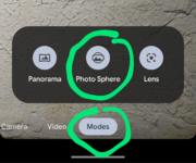
I used to use Photoshop to stitch my photosphere together but I noticed my Android Pixel 5 phone will create a really nice photosphere all on its own. That said though I'm also interested in figuring out what resolution these 2:1 files should be. My phone produces a file that's 8000 x 4000 pixels which looked fairly good in the sim. However my old RF 4.5 raw photosphere images were much higher at 20000 x 10000 pixels. Not sure if that gets upscaled/downscaled when importing into RF?
 
Has anyone tried to use one of the 360 photo apps on android to create the image? I'm thinking something like this with google street view app
 
I've not used the Google Street View app but that looks almost identical to my Android Pixel 5's built in Photo Sphere mode for its camera. As stated above, that produces a 2:1 8000x4000 pixel JPEG that imports into Real Flight no problem.

photo sphere Pixel andorid.png
 
Great info here guys, will have a go at this tomorrow with Realflight Evolution :D Hope it works
 
Back
Top