Fun2av8RC
Member
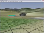
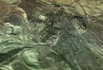
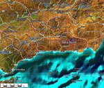
While preparing to create a new airport - I zoomed out 50 Miles (?) and noticed that when you zoom out far enough you begin to see what appears to be towns, rivers, industrial areas, etc. I found one spot just north east of the CMB Flying Field that looks like an industrial complex complete with a small town and railroad tracks. When I zoom in to investigate - the topography loses its definition and becomes flat.
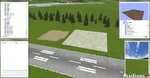
They are one-dimensional as there this no depth to them. Trees are two-dimensional and appear intermixed with the one dimensional topography.
I have a couple of questions.
1) Just where in the world is this slice of geography that makes up the Real Flight World?
2) Is it possible to turn the one-dimensional areas into two-dimensions?
3) When scrolling for locations for a new airport - I sometimes loose my orientation. Is there anyway to get latitude/longitude references? They don't have to be real. Just some way to relocate a spot or location. I know you can drop a pilot / plane spawn and get back to that spot. I'm just wondering if there is a way to find a location using coordinates of some kind.
")